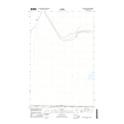
2017 Map of Maple Falls OE N
USGS Topo · Published 2017About this map
The international border between Canada and the United States of America serves as the focal point for this survey along the northern edge of Whatcom Co. The landscape is defined by the proximity to the 49th parallel, where the small community of Peaceful Valley sits just south of the boundary line. The geography here is marked by the transition between nations, with the surveying showing the rectilinear township system of t41n r5e and t41n r6e meeting the international frontier. This map provides a look at the rural boundary lands in the Pacific Northwest during the early 21st century, documenting the road networks and hydrography that cross the border into British Columbia.
Find a feature on this map
6 named features on this map. Tap any name to fly to it.
Don’t see what you’re looking for? This feature index may not catch every label — zoom into the map to look around manually.
Map Details
Editions of this 2017 Maple Falls OE N Map
This is the sole edition of this map. No revisions or reprints were ever made.
Other maps of this area

1909 · Mt Baker
USGS Topo · 1:192,000

1915 · Mt. Baker
USGS Topo · 1:250,000

1919 · Van Zandt
USGS Topo · 1:62,500

1951 · Van Zandt
USGS Topo · 1:62,500

1952 · Mt. Baker
USGS Topo · 1:62,500

1955 · Concrete
USGS Topo · 1:250,000

1957 · Victoria
USGS Topo · 1:250,000

1958 · Concrete
USGS Topo · 1:250,000

1962 · Concrete
USGS Topo · 1:250,000

1972 · Maple Falls
USGS Topo · 1:24,000