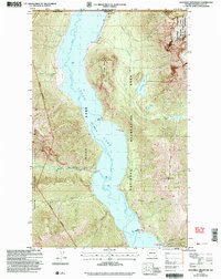
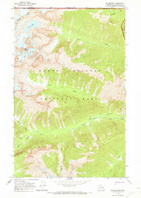
2002 Map of Hozomeen Mountain
USGS Topo · Published 2006About this map
Ross Lake dominates this international border landscape, where the waters of the Skagit River are held at a spillway elevation of 1604 feet. The map captures the remote wilderness where Whatcom County meets British Columbia, defined by the high peaks of Hozomeen Mountain and Desolation Peak. These heights are home to significant fire lookout infrastructure at Desolation Lookout, accessible by the Desolation Lookout Trail.
Find a feature on this map
39 named features on this map. Tap any name to fly to it.
Don’t see what you’re looking for? This feature index may not catch every label — zoom into the map to look around manually.
Map Details
Editions of this 2002 Hozomeen Mountain Map
This is the sole edition of this map. No revisions or reprints were ever made.
Other maps of this area

1920 · Slate Pass
USGS Topo · 1:125,000

1955 · Concrete
USGS Topo · 1:250,000

1958 · Concrete
USGS Topo · 1:250,000

1962 · Concrete
USGS Topo · 1:250,000

1969 · Skagit Peak
USGS Topo · 1:24,000

1969 · Mt Prophet
USGS Topo · 1:24,000
1969 · Jack Mtn
USGS Topo · 1:24,000
1969 · Pumpkin Mtn.
USGS Topo · 1:24,000
1969 · Hozomeen Mtn
USGS Topo · 1:24,000
1969 · Mt Spickard
USGS Topo · 1:24,000