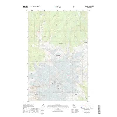
2020 Map of Mount Baker
USGS Topo · Published 2020About this map
Mt Baker dominates the landscape of the Mount Baker National Forest, where high-altitude geology and glacial movement are meticulously documented. The summit area is defined by the Summit Crater and the nearby Sherman Crater, flanked by prominent heights such as Grant Peak, Colfax Peak, and the Black Buttes. The mapping of Chromatic Moraine and Crater Moraine illustrates the historical and ongoing impact of ice on this terrain, while drainage patterns from Heliotrope Cr and Glacier Cr flow away from the central massif.
Find a feature on this map
60 named features on this map. Tap any name to fly to it.
Don’t see what you’re looking for? This feature index may not catch every label — zoom into the map to look around manually.
Map Details
Editions of this 2020 Mount Baker Map
This is the sole edition of this map. No revisions or reprints were ever made.
Other maps of this area

1909 · Mt Baker
USGS Topo · 1:192,000

1915 · Mt. Baker
USGS Topo · 1:250,000

1952 · Lake Shannon
USGS Topo · 1:62,500

1952 · Mt. Baker
USGS Topo · 1:62,500

1952 · Hamilton
USGS Topo · 1:62,500

1953 · Mt Shuksan
USGS Topo · 1:62,500

1955 · Concrete
USGS Topo · 1:250,000

1958 · Concrete
USGS Topo · 1:250,000

1962 · Concrete
USGS Topo · 1:250,000
1973 · Hamilton
USGS Topo · 1:62,500