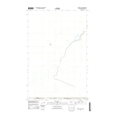
2014 Map of Kendall OE N
USGS Topo · Published 2014About this map
Agricultural activity and hydrological patterns define this border region north of the Washington state line. The landscape is characterized by its proximity to the international boundary between Canada and the United States of America, where the rural character is anchored by established operations like Vreugdenhil Farms and the Vedder Mountain Dairy. The presence of these named agricultural sites suggests a persistent land-use pattern dedicated to large-scale farming and dairy production. Water management is a visible priority in this low-lying area, evidenced by Arnold Slough, which serves the drainage needs of the surrounding fields. The map provides a clear look at the intersection of international geography and the local dairy industry in the Fraser Valley region during the early twenty-first century.
Find a feature on this map
7 named features on this map. Tap any name to fly to it.
Don’t see what you’re looking for? This feature index may not catch every label — zoom into the map to look around manually.
Map Details
Editions of this 2014 Kendall OE N Map
This is the sole edition of this map. No revisions or reprints were ever made.
Other maps of this area

1906 · Sumas
USGS Topo · 1:62,500

1908 · Sumas
USGS Topo · 1:62,500

1919 · Van Zandt
USGS Topo · 1:62,500

1951 · Van Zandt
USGS Topo · 1:62,500

1952 · Sumas
USGS Topo · 1:24,000

1954 · Lynden
USGS Topo · 1:62,500

1957 · Victoria
USGS Topo · 1:250,000

1972 · Maple Falls
USGS Topo · 1:24,000
1972 · Kendall
USGS Topo · 1:24,000

1975 · Bellingham
USGS Topo · 1:100,000