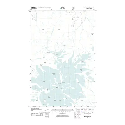
2011 Map of Mount Baker
USGS Topo · Published 2011About this map
Mount Baker dominates this glacial landscape, serving as the central spire for an extensive network of ice and volcanic features. The survey highlights the mountain's active character, noting the Dorr Fumarole Field and prominent features like the Roman Wall and Grant Peak. Surrounding the summit, massive ice flows such as the Coleman Glacier, Roosevelt Glacier, and Deming Glacier reach down toward the drainage basins of Heliotrope Creek and Wells Creek. For researchers, the map provides a precise record of the mountain's topography, identifying established landmarks like the Kulshan Cabin and vantage points such as Lahar Lookout. The high-elevation terrain is defined by sharp ridges like Skyline Divide and Bastile Ridge, which separate the various glacial systems and alpine basins.
Find a feature on this map
58 named features on this map. Tap any name to fly to it.
Don’t see what you’re looking for? This feature index may not catch every label — zoom into the map to look around manually.
Map Details
Editions of this 2011 Mount Baker Map
This is the sole edition of this map. No revisions or reprints were ever made.
Other maps of this area

1909 · Mt Baker
USGS Topo · 1:192,000

1915 · Mt. Baker
USGS Topo · 1:250,000

1952 · Lake Shannon
USGS Topo · 1:62,500

1952 · Mt. Baker
USGS Topo · 1:62,500

1952 · Hamilton
USGS Topo · 1:62,500

1953 · Mt Shuksan
USGS Topo · 1:62,500

1955 · Concrete
USGS Topo · 1:250,000

1958 · Concrete
USGS Topo · 1:250,000

1962 · Concrete
USGS Topo · 1:250,000
1973 · Hamilton
USGS Topo · 1:62,500