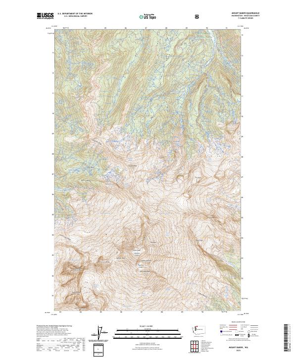
2023 Map of Mount Baker
USGS Topo · Published 2023About this map
Mt Baker dominates this glacial landscape within the Mount Baker Wilderness, showcasing the complex topography of one of the Pacific Northwest's most active volcanic peaks. The map details a massive radial drainage system where numerous ice fields, including the Roosevelt Glacier, Mazama Glacier, and the expansive Coleman Glacier, carve deep into the volcanic flanks. High-altitude landmarks like Grant Peak, Sherman Peak, and the Summit Crater provide specific points of reference for the mountain's crest, while the Roman Wall and Lahar Lookout suggest the dramatic volcanic history of the area.
Find a feature on this map
73 named features on this map. Tap any name to fly to it.
Don’t see what you’re looking for? This feature index may not catch every label — zoom into the map to look around manually.
Map Details
Editions of this 2023 Mount Baker Map
This is the sole edition of this map. No revisions or reprints were ever made.
Other maps of this area

1909 · Mt Baker
USGS Topo · 1:192,000

1915 · Mt. Baker
USGS Topo · 1:250,000

1952 · Lake Shannon
USGS Topo · 1:62,500

1952 · Mt. Baker
USGS Topo · 1:62,500

1952 · Hamilton
USGS Topo · 1:62,500

1953 · Mt Shuksan
USGS Topo · 1:62,500

1955 · Concrete
USGS Topo · 1:250,000

1958 · Concrete
USGS Topo · 1:250,000

1962 · Concrete
USGS Topo · 1:250,000
1973 · Hamilton
USGS Topo · 1:62,500