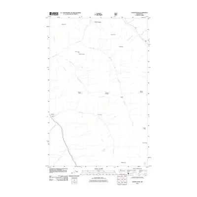
2011 Map of Azurite Peak
USGS Topo · Published 2011About this map
Cedar Crossing serves as a central point of reference in this high-altitude landscape of the North Cascades during the early twenty-first century. The area is defined by a intricate network of drainage systems, including the waters of Friday Creek, which carve through the steep terrain. This map provides a look at the land as managed by the US Forest Service, showing the intersection of natural watercourses and the limited human footprint of the period. Researchers of mountain geography will find the hydrography particularly useful for understanding the orientation of local valleys and peaks in the Whatcom County backcountry.
Find a feature on this map
2 named features on this map. Tap any name to fly to it.
Don’t see what you’re looking for? This feature index may not catch every label — zoom into the map to look around manually.
Map Details
Editions of this 2011 Azurite Peak Map
This is the sole edition of this map. No revisions or reprints were ever made.
Other maps of this area

1920 · Slate Pass
USGS Topo · 1:125,000

1955 · Concrete
USGS Topo · 1:250,000

1958 · Concrete
USGS Topo · 1:250,000

1962 · Concrete
USGS Topo · 1:250,000

1963 · Washington Pass
USGS Topo · 1:24,000

1963 · Azurite Peak
USGS Topo · 1:24,000

1963 · Slate Peak
USGS Topo · 1:24,000
1963 · Mt. Arriva
USGS Topo · 1:24,000
1963 · Mt Logan
USGS Topo · 1:24,000

1963 · Crater Mountain
USGS Topo · 1:24,000