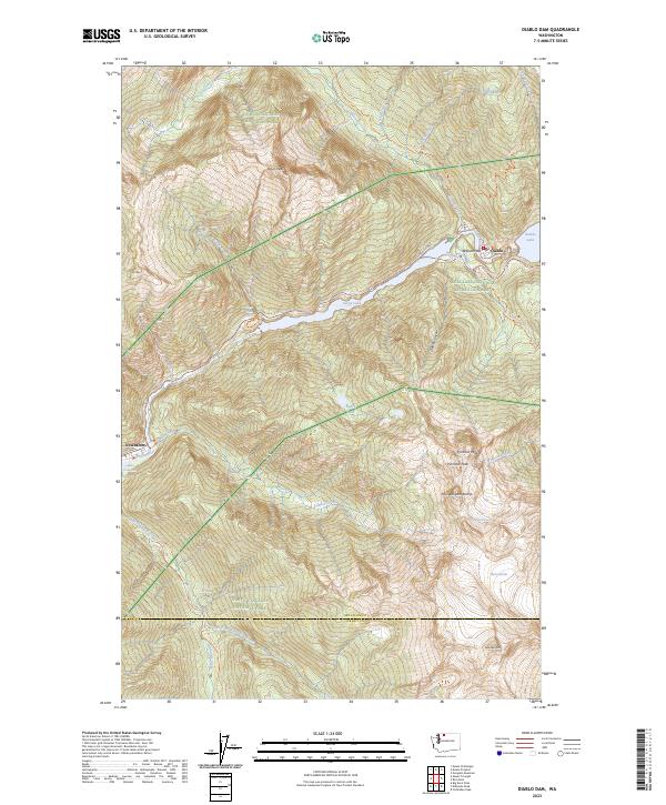
2023 Map of Diablo Dam
USGS Topo · Published 2023About this map
Skagit River hydro-electric infrastructure dominates this mountainous landscape in the 2020s, anchoring the company towns of Newhalem and Diablo. The corridor is defined by a series of impoundments including Gorge Lake and Diablo Lake, which facilitate power generation for the region. Beyond the industrial footprint at Reflector Bar, the map details a high-elevation wilderness protected within North Cascades National Park and the Stephen Mather Wilderness. Permanent ice features like Colonial Glacier and Neve Glacier sit among the summits of Pyramid Peak and Pinnacle Peak. Topography is characterized by significant relief, where Gorge Creek Falls and Ladder Creek Falls drop steeply toward the river valley. Numerous recreation routes, such as the Sourdough Trl and Newhalem Creek Trl, provide access to the surrounding peaks.
Find a feature on this map
62 named features on this map. Tap any name to fly to it.
Don’t see what you’re looking for? This feature index may not catch every label — zoom into the map to look around manually.
Map Details
Editions of this 2023 Diablo Dam Map
This is the sole edition of this map. No revisions or reprints were ever made.
Other maps of this area

1953 · Marblemount
USGS Topo · 1:62,500

1953 · Mt Challenger
USGS Topo · 1:62,500

1955 · Concrete
USGS Topo · 1:250,000

1958 · Concrete
USGS Topo · 1:250,000

1962 · Concrete
USGS Topo · 1:250,000

1963 · Eldorado Peak
USGS Topo · 1:24,000
1963 · Forbidden Peak
USGS Topo · 1:24,000

1963 · Diablo Dam
USGS Topo · 1:24,000

1963 · Ross Dam
USGS Topo · 1:24,000

1969 · Mt Prophet
USGS Topo · 1:24,000