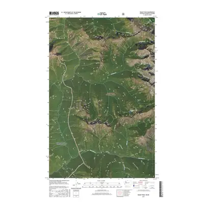
2017 Map of Skagit Peak
USGS Topo · Published 2017About this map
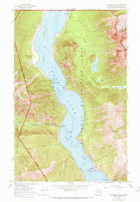
Skagit Peak and the high ridges of the North Cascades define this landscape along the international border with British Columbia. The terrain is divided between protected federal lands, including the Mount Baker National Forest and the Ross Lake National Recreation Area. High-altitude features like Freezeout Mtn and Joker Mtn rise above glacial carved depressions such as Welcome Basin and Elbow Basin. The hydrological network is dominated by steep-gradient drainages like Three Fools Cr and Boundary Cr, which feed the region's larger river systems. A significant passage through this wilderness is marked by Castle Pass, a historically important route for those navigating the divide between Whatcom Co and Okanogan Co. The presence of Freezeout Lake near the pass illustrates the typical alpine lake formations found at these elevations.
Find a feature on this map
20 named features on this map. Tap any name to fly to it.
Don’t see what you’re looking for? This feature index may not catch every label — zoom into the map to look around manually.
Map Details
Editions of this 2017 Skagit Peak Map
This is the sole edition of this map. No revisions or reprints were ever made.
Other maps of this area

1920 · Slate Pass
USGS Topo · 1:125,000

1955 · Concrete
USGS Topo · 1:250,000

1958 · Concrete
USGS Topo · 1:250,000

1962 · Concrete
USGS Topo · 1:250,000

1969 · Skagit Peak
USGS Topo · 1:24,000
1969 · Jack Mtn
USGS Topo · 1:24,000
1969 · Shull Mtn.
USGS Topo · 1:24,000
1969 · Pumpkin Mtn.
USGS Topo · 1:24,000
1969 · Hozomeen Mtn
USGS Topo · 1:24,000

1979 · Mt. Baker
USGS Topo · 1:100,000