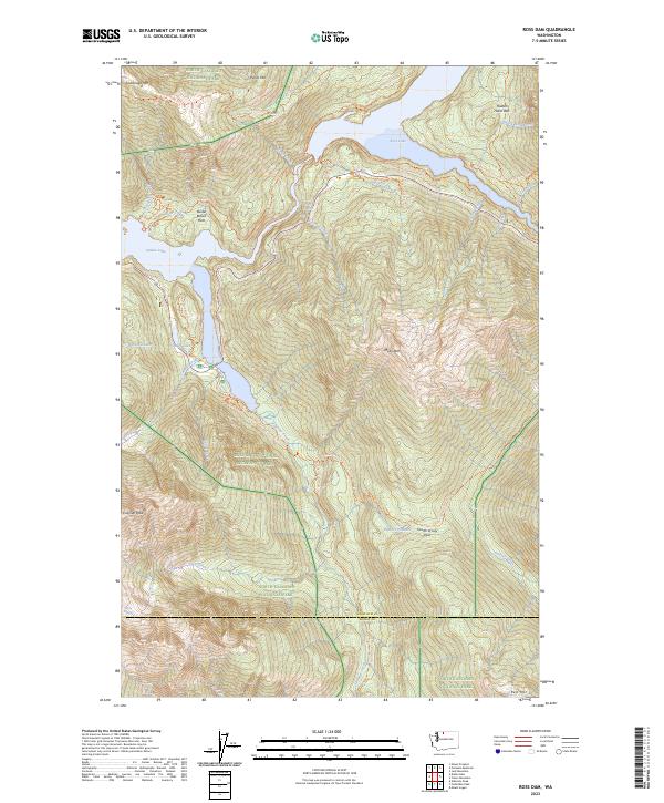
2023 Map of Ross Dam
USGS Topo · Published 2023About this map
Ross Lake and Diablo Lake anchor this high-altitude landscape within the North Cascades National Park and the Ross Lake National Recreation Area. The geography is defined by steep relief, stretching from the water's edge to the ice-carved heights of Colonial Peak and Ruby Mtn. Trace the historical footprint of early mountain access via the Happy Creek Mill Trl and the Sourdough Trl, which navigate the terrain surrounding Sourdough Mtn. The persistence of the Neve Glacier above Neve Creek provides a significant indicator of the region's glaciated character. Unique local naming is evident at Buster Brown Flats and John Pierce Waterfall, while the rugged transit through the range is marked by the Fourth of July Pass. The network of water bodies, including Thunder Lake and Pyramid Lake, underscores the complex drainage patterns feeding the primary reservoirs.
Find a feature on this map
50 named features on this map. Tap any name to fly to it.
Don’t see what you’re looking for? This feature index may not catch every label — zoom into the map to look around manually.
Map Details
Editions of this 2023 Ross Dam Map
This is the sole edition of this map. No revisions or reprints were ever made.
Other maps of this area

1920 · Slate Pass
USGS Topo · 1:125,000

1955 · Concrete
USGS Topo · 1:250,000

1958 · Concrete
USGS Topo · 1:250,000

1962 · Concrete
USGS Topo · 1:250,000

1963 · Eldorado Peak
USGS Topo · 1:24,000
1963 · Forbidden Peak
USGS Topo · 1:24,000
1963 · Mt Logan
USGS Topo · 1:24,000

1963 · Crater Mountain
USGS Topo · 1:24,000

1963 · Diablo Dam
USGS Topo · 1:24,000

1963 · Ross Dam
USGS Topo · 1:24,000