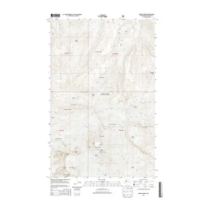
2014 Map of Mount Baker
USGS Topo · Published 2014About this map
Mt Baker dominates this 2014 survey of the high cascades in Mount Baker National Forest. The map documents the complex glacial and volcanic anatomy of the peak, featuring the Summit Crater and Sherman Crater alongside the sheer drop of the Roman Wall. A massive network of ice flows is recorded here, including the Coleman Glacier, Roosevelt Glacier, and Mazama Glacier, which carve into ridges like Chowder Ridge and the Cockscomb. The terrain transition is sharp, moving from the forested reaches near Kulshan Cabin to the active geothermal features of the Dorr Fumarole Field. For those studying glaciology or the shifting alpine environment, the map details numerous terminal features like the Crater Moraine and Chromatic Moraine, providing a precise record of the ice margins at this recent date.
Find a feature on this map
61 named features on this map. Tap any name to fly to it.
Don’t see what you’re looking for? This feature index may not catch every label — zoom into the map to look around manually.
Map Details
Editions of this 2014 Mount Baker Map
This is the sole edition of this map. No revisions or reprints were ever made.
Other maps of this area

1909 · Mt Baker
USGS Topo · 1:192,000

1915 · Mt. Baker
USGS Topo · 1:250,000

1952 · Lake Shannon
USGS Topo · 1:62,500

1952 · Mt. Baker
USGS Topo · 1:62,500

1952 · Hamilton
USGS Topo · 1:62,500

1953 · Mt Shuksan
USGS Topo · 1:62,500

1955 · Concrete
USGS Topo · 1:250,000

1958 · Concrete
USGS Topo · 1:250,000

1962 · Concrete
USGS Topo · 1:250,000
1973 · Hamilton
USGS Topo · 1:62,500