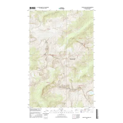
2017 Map of Mount Challenger
USGS Topo · Published 2017About this map
Mount Challenger and the surrounding high country of the Picket Range dominate this 2017 survey of Whatcom County. Located within the North Cascades National Park, the area is defined by sharp peaks and high-elevation basins, including the waters of Luna Lake, Azure Lake, and the smaller Wiley Lake. The terrain is characterized by dramatic vertical relief, featuring named summits like Mt Terror, McMillan Spire, and the Crooked Thumb Peak.
Find a feature on this map
36 named features on this map. Tap any name to fly to it.
Don’t see what you’re looking for? This feature index may not catch every label — zoom into the map to look around manually.
Map Details
Editions of this 2017 Mount Challenger Map
This is the sole edition of this map. No revisions or reprints were ever made.
Other maps of this area

1953 · Marblemount
USGS Topo · 1:62,500

1953 · Mt Challenger
USGS Topo · 1:62,500

1955 · Concrete
USGS Topo · 1:250,000

1958 · Concrete
USGS Topo · 1:250,000

1962 · Concrete
USGS Topo · 1:250,000

1963 · Diablo Dam
USGS Topo · 1:24,000

1969 · Mt Prophet
USGS Topo · 1:24,000
1969 · Mt Spickard
USGS Topo · 1:24,000

1979 · Mt. Baker
USGS Topo · 1:100,000
1989 · Copper Mountain
USGS Topo · 1:24,000