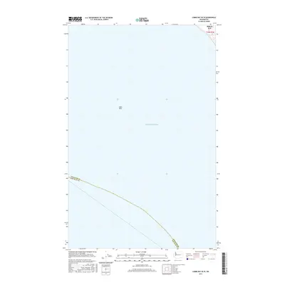
2017 Map of Lummi Bay OE W
USGS Topo · Published 2017About this map
Puget Sound dominates this nautical-focused survey, showcasing the maritime boundary between Whatcom Co and San Juan Co. The map focuses primarily on the open waters of the sound, highlighting the underwater topography of Alden Bank in the central portion of the quadrangle. Along the northeastern edge, the shoreline of Birch Bay becomes visible, marking a transition from the deep sound to the sheltered coastal waters of the mainland. This perspective emphasizes the importance of bathymetric features and political maritime borders in the Salish Sea, providing a clear record of how county jurisdictions extend into the sea.
Find a feature on this map
4 named features on this map. Tap any name to fly to it.
Don’t see what you’re looking for? This feature index may not catch every label — zoom into the map to look around manually.
Map Details
Editions of this 2017 Lummi Bay OE W Map
This is the sole edition of this map. No revisions or reprints were ever made.
Other maps of this area

1907 · Blaine
USGS Topo · 1:62,500

1943 · Orcas Island
USGS Topo · 1:62,500

1943 · Anacortes
USGS Topo · 1:62,500

1951 · Anacortes
USGS Topo · 1:62,500

1952 · Birch Point
USGS Topo · 1:24,000

1952 · Lummi Bay
USGS Topo · 1:24,000

1952 · Blaine
USGS Topo · 1:24,000

1952 · Blaine
USGS Topo · 1:62,500

1957 · Orcas Island
USGS Topo · 1:62,500

1957 · Victoria
USGS Topo · 1:250,000