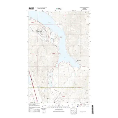
2014 Map of Lake Whatcom
USGS Topo · Published 2014About this map
Lake Whatcom dominates this 2014 survey, stretching through the center of a landscape defined by the steep elevation of Lookout Mtn and Anderson Mtn. The residential development at Sudden Valley sits on the western shore, featuring a complex network of winding roads like Lake Whatcom Blvd and Jasper Ridge Ln that contrast with the more rural, dispersed settlements of Sunnyside and Blue Canyon.
Find a feature on this map
89 named features on this map. Tap any name to fly to it.
Don’t see what you’re looking for? This feature index may not catch every label — zoom into the map to look around manually.
Map Details
Editions of this 2014 Lake Whatcom Map
This is the sole edition of this map. No revisions or reprints were ever made.
Other maps of this area

1906 · Sumas
USGS Topo · 1:62,500

1908 · Sumas
USGS Topo · 1:62,500

1918 · Samish Lake
USGS Topo · 1:62,500

1919 · Van Zandt
USGS Topo · 1:62,500

1921 · Wickersham
USGS Topo · 1:62,500

1951 · Wickersham
USGS Topo · 1:62,500

1951 · Van Zandt
USGS Topo · 1:62,500

1952 · Lake Whatcom
USGS Topo · 1:24,000

1952 · Lawrence
USGS Topo · 1:24,000

1952 · Alger
USGS Topo · 1:24,000