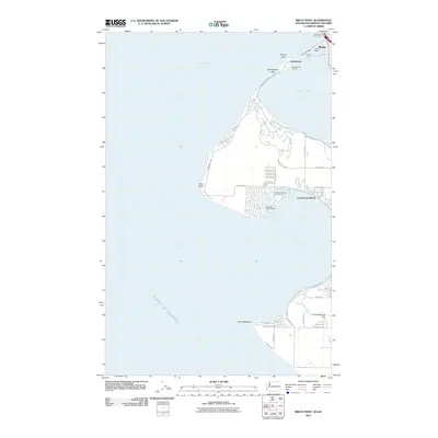
2011 Map of Birch Point
USGS Topo · Published 2011About this map
Semiahmoo Spit stretches into the waters of Semiahmoo Bay, forming a natural barrier for Drayton Harbor and the Port of Blaine at the international border. This coastal landscape is defined by its maritime infrastructure, featuring the Semiahmoo Marina and the southern Birch Bay Village Marina. The residential and recreational layout of the early 21st century is visible in the dense network of roads around Cottonwood Beach and the fairways of the Birch Bay Village Golf Course. To the north, the Peace Arch Port of Entry serves as a critical transit point between the United States and Canada. Further south, the terrain includes the notable headlands of Birch Point and Point Whitehorn, while inland, Terrell Creek feeds into the Unruh Reservoir, regulated by the Unruh Reservoir Dam.
Find a feature on this map
47 named features on this map. Tap any name to fly to it.
Don’t see what you’re looking for? This feature index may not catch every label — zoom into the map to look around manually.
Map Details
Editions of this 2011 Birch Point Map
This is the sole edition of this map. No revisions or reprints were ever made.
Other maps of this area

1907 · Blaine
USGS Topo · 1:62,500

1952 · Birch Point
USGS Topo · 1:24,000

1952 · Lummi Bay
USGS Topo · 1:24,000

1952 · Blaine
USGS Topo · 1:24,000

1952 · Blaine
USGS Topo · 1:62,500

1957 · Victoria
USGS Topo · 1:250,000

1973 · Sucia Island
USGS Topo · 1:24,000

1975 · Bellingham
USGS Topo · 1:100,000
1997 · Lummi Bay
USGS Topo · 1:24,000
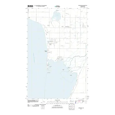
2011 · Lummi Bay
USGS Topo · 1:24,000