
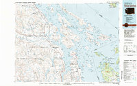
1973 Map of Sucia Island
USGS Topo · Published 1977About this map
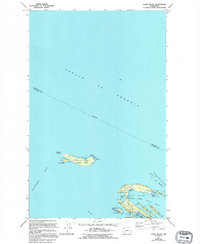
Patos Island and Sucia Island stand as the primary landmasses in this northern reach of the San Juan archipelago, where the Strait of Georgia meets Boundary Pass. This 1970s survey documents the critical maritime and conservation infrastructure of the era, including the U S Coast Guard Reservation surrounding Patos Light at Alden Pt. The geography of the islands is highly articulated, featuring finger-like peninsulas and sheltered coves such as Fossil Bay, Echo Bay, and Shallow Bay. Much of the territory is dedicated to public and protected use, shown through Sucia Island State Park and portions of the San Juan Islands National Wildlife Refuge. The map details numerous established campgrounds, suggesting the islands' mid-century role as a destination for marine recreation and environmental preservation.
Find a feature on this map
33 named features on this map. Tap any name to fly to it.
Don’t see what you’re looking for? This feature index may not catch every label — zoom into the map to look around manually.
Map Details
Editions of this 1973 Sucia Island Map
2 editions found
Other maps of this area

1943 · Orcas Island
USGS Topo · 1:62,500
1952 · Point Roberts
USGS Topo · 1:24,000

1952 · Birch Point
USGS Topo · 1:24,000

1954 · Waldron Island
USGS Topo · 1:24,000

1957 · Orcas Island
USGS Topo · 1:62,500

1957 · Victoria
USGS Topo · 1:250,000

1975 · Bellingham
USGS Topo · 1:100,000
1977 · Eastsound
USGS Topo · 1:24,000
1978 · Mt Constitution
USGS Topo · 1:24,000
1981 · Roche Harbor
USGS Topo · 1:100,000