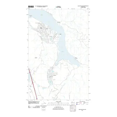
2011 Map of Lake Whatcom
USGS Topo · Published 2011About this map
Lake Whatcom dominates this 2011 survey, showing a landscape defined by waterfront settlements and specialized transportation hubs. To the west, the developed community of Sudden Valley sits near the Floathaven Seaplane Base and the adjacent Floathaven Airstrip, highlighting the area's integration of air and water travel. The map captures the rugged eastern shore of the lake near Blue Canyon, where the terrain rises sharply toward Lookout Mountain. To the south, a chain of smaller water bodies including Cain Lake, Reed Lake, and Squires Lake follows the corridor of the Pacific Hwy. The presence of the Louise Lake Dam and Glenhaven Lakes Dam illustrates the management of the local watershed that supports the residential clusters of Glenhaven and Sunnyside.
Find a feature on this map
46 named features on this map. Tap any name to fly to it.
Don’t see what you’re looking for? This feature index may not catch every label — zoom into the map to look around manually.
Map Details
Editions of this 2011 Lake Whatcom Map
This is the sole edition of this map. No revisions or reprints were ever made.
Other maps of this area

1906 · Sumas
USGS Topo · 1:62,500

1908 · Sumas
USGS Topo · 1:62,500

1918 · Samish Lake
USGS Topo · 1:62,500

1919 · Van Zandt
USGS Topo · 1:62,500

1921 · Wickersham
USGS Topo · 1:62,500

1951 · Wickersham
USGS Topo · 1:62,500

1951 · Van Zandt
USGS Topo · 1:62,500

1952 · Lake Whatcom
USGS Topo · 1:24,000

1952 · Lawrence
USGS Topo · 1:24,000

1952 · Alger
USGS Topo · 1:24,000