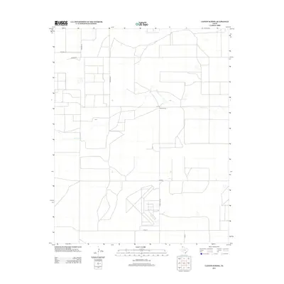
2012 Map of Canyon School
USGS Topo · Published 2012About this map
Canyon School stands as a focal point in this northwestern Texas landscape, located just off FM-1727 in a region characterized by its large-scale agricultural and ranching grid. The intermittent flow of Carrizo Cr winds across the northern portion of the quadrangle, providing a rare natural drainage feature in an area otherwise dominated by straight-line section roads. Local family and ranch names are preserved in the road network, including Newman Rd, Brorman Rd, and Richards Rd, which define the property boundaries and transport routes of Hartley County. The presence of Ranch Road 694 and various county roads like Co Road B illustrates the rural infrastructure supporting the isolated farmsteads and schools of the High Plains during the early twenty-first century.
Find a feature on this map
11 named features on this map. Tap any name to fly to it.
Don’t see what you’re looking for? This feature index may not catch every label — zoom into the map to look around manually.
Map Details
Editions of this 2012 Canyon School Map
This is the sole edition of this map. No revisions or reprints were ever made.
Other maps of this area

1954 · Tucumcari
USGS Topo · 1:250,000

1954 · Dalhart
USGS Topo · 1:250,000

1958 · Tucumcari
USGS Topo · 1:250,000

1958 · Dalhart
USGS Topo · 1:250,000

1962 · Dalhart
USGS Topo · 1:250,000

1971 · Syndicate Hills
USGS Topo · 1:24,000

1973 · Pardue Camp
USGS Topo · 1:24,000

1973 · Wharton Ranch
USGS Topo · 1:24,000

1973 · King
USGS Topo · 1:24,000

1973 · Canyon School
USGS Topo · 1:24,000