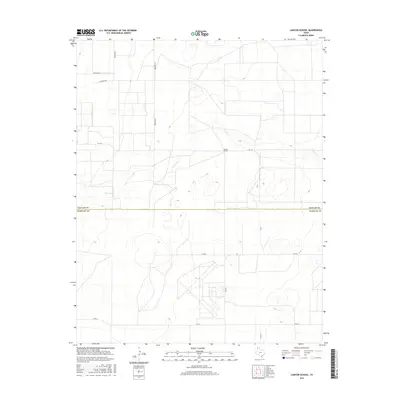
2016 Map of Canyon School
USGS Topo · Published 2016About this map
The high plains of the Texas Panhandle define this landscape along the border of Dallam and Hartley counties. At its heart stands Canyon School, a central point in a sparsely populated region characterized by a rectilinear grid of ranch and farm roads. The seasonal drainage of Carrizo Cr meanders across the terrain, providing a natural break in the otherwise ordered system of thoroughfares like Brorman Rd and Newman Rd. This survey reflects the modern agricultural character of the region, where family names are often preserved in the local geography through landmarks like Richards Rd. It remains a remote area of Texas where long-distance transportation is facilitated by routes such as Fm 1727 and Fm 694.
Find a feature on this map
12 named features on this map. Tap any name to fly to it.
Don’t see what you’re looking for? This feature index may not catch every label — zoom into the map to look around manually.
Map Details
Editions of this 2016 Canyon School Map
This is the sole edition of this map. No revisions or reprints were ever made.
Other maps of this area

1954 · Tucumcari
USGS Topo · 1:250,000

1954 · Dalhart
USGS Topo · 1:250,000

1958 · Tucumcari
USGS Topo · 1:250,000

1958 · Dalhart
USGS Topo · 1:250,000

1962 · Dalhart
USGS Topo · 1:250,000

1971 · Syndicate Hills
USGS Topo · 1:24,000

1973 · Pardue Camp
USGS Topo · 1:24,000

1973 · Wharton Ranch
USGS Topo · 1:24,000

1973 · King
USGS Topo · 1:24,000

1973 · Canyon School
USGS Topo · 1:24,000