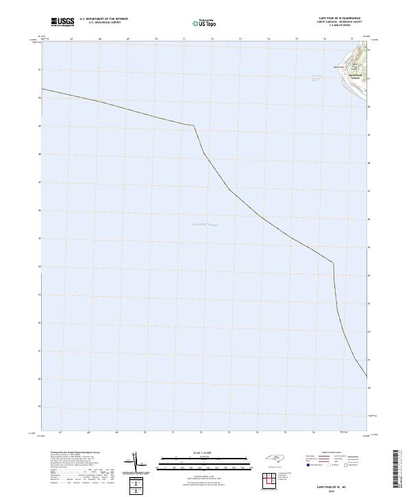
2022 Map of Cape Fear OE W
USGS Topo · Published 2022About this map
Bald Head Island occupies the upper right corner of this survey, representing the southernmost tip of North Carolina's coastal barrier systems where the land meets the vast Atlantic Ocean. The map primarily illustrates the maritime approaches and coastal waters surrounding this distinctive landform, highlighting the critical Bald Head Channel Range used for navigation into the Cape Fear River estuary. On the island itself, the transition from maritime forest to shoreline is traced by local routes like Cape Fear Trl, W Bald Head Wynd, and S Bald Head Wynd. These road patterns reflect the modern residential and conservancy footprint of the island, contrasting with the expansive open water that dominates the quadrangle. For those studying coastal geography, the sheet provides a precise look at the 2022 shoreline of Bald Head and its relationship to the deep-water channels required for shipping traffic.
Find a feature on this map
8 named features on this map. Tap any name to fly to it.
Don’t see what you’re looking for? This feature index may not catch every label — zoom into the map to look around manually.
Map Details
Editions of this 2022 Cape Fear OE W Map
This is the sole edition of this map. No revisions or reprints were ever made.
Other maps of this area

1942 · Cape Fear
USGS Topo · 1:24,000

1943 · Lockwoods Folly
USGS Topo · 1:24,000

1944 · Lockwoods Folly
USGS Topo · 1:31,680

1946 · Southport
USGS Topo · 1:24,000

1946 · Snow Marsh
USGS Topo · 1:24,000

1949 · Georgetown
USGS Topo · 1:250,000

1967 · Georgetown
USGS Topo · 1:250,000
1969 · Southport
USGS Topo · 1:24,000
1970 · Kure Beach
USGS Topo · 1:24,000
1970 · Cape Fear
USGS Topo · 1:24,000