
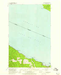
1938 Map of Cape Flattery
USGS Topo · Published 1938About this map
Neah Bay stands as the primary hub of the Makah Indian Reservation on this 1938 tactical survey of the Olympic Peninsula's northwestern tip. The local maritime economy is clearly defined by Washburns Dock and the Washburns Cannery, emphasizing the region's reliance on the surrounding waters. To the west, Cape Flattery and Tatoosh Island mark the entrance to the Strait of Juan de Fuca, a critical maritime boundary between the United States and the Dominion of Canada. Inland, the map reveals a series of private holdings including Holdens Ranch, Tylers Ranch, and Hunters Ranch, while infrastructure like the Neah Bay S H and Washburn S H serves the remote population. The presence of the U. S. Military Agency Reserve underscores the strategic importance of this coastline in the late 1930s.
Find a feature on this map
44 named features on this map. Tap any name to fly to it.
Don’t see what you’re looking for? This feature index may not catch every label — zoom into the map to look around manually.
Map Details
Editions of this 1938 Cape Flattery Map
This is the sole edition of this map. No revisions or reprints were ever made.
Other maps of this area

1935 · Clallam
USGS Topo · 1:62,500

1935 · Ozette Lake
USGS Topo · 1:62,500

1935 · Lake Pleasant
USGS Topo · 1:62,500

1942 · Clallam
USGS Topo · 1:62,500

1942 · Ozette Lake
USGS Topo · 1:62,500

1942 · Lake Pleasant
USGS Topo · 1:62,500

1953 · Cape Flattery
USGS Topo · 1:250,000

1956 · Ozette Lake
USGS Topo · 1:62,500

1957 · Lake Pleasant
USGS Topo · 1:62,500
1957 · Clallam Bay
USGS Topo · 1:62,500