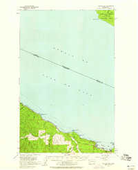
1957 Map of Clallam Bay
USGS Topo · Published 1959About this map
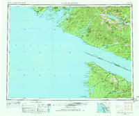
The Strait Of Juan De Fuca dominates this coastal survey, marking the international maritime boundary between Washington State and British Columbia. On the Olympic Peninsula shore, the twin settlements of Sekiu and Clallam Bay serve as the primary hubs of activity, linked by a coastline punctuated by dramatic landmarks like Slip Point and Shipwreck Point. The inland landscape is defined by the industrial timber operations of the late 1950s, evidenced by a Logging Railroad winding through the hills and numerous forest access points like a Jeep Trail.
Find a feature on this map
29 named features on this map. Tap any name to fly to it.
Don’t see what you’re looking for? This feature index may not catch every label — zoom into the map to look around manually.
Map Details
Editions of this 1957 Clallam Bay Map
3 editions found
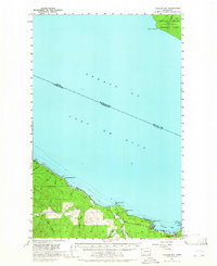
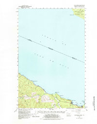
Other maps of this area
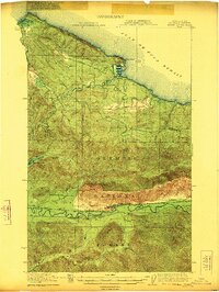
1922 · Pysht
USGS Topo · 1:62,500

1935 · Clallam
USGS Topo · 1:62,500

1935 · Ozette Lake
USGS Topo · 1:62,500

1935 · Lake Pleasant
USGS Topo · 1:62,500

1938 · Cape Flattery
USGS Topo · 1:62,500

1942 · Pysht
USGS Topo · 1:62,500

1942 · Clallam
USGS Topo · 1:62,500

1942 · Ozette Lake
USGS Topo · 1:62,500

1942 · Lake Pleasant
USGS Topo · 1:62,500
1953 · Cape Flattery
USGS Topo · 1:250,000