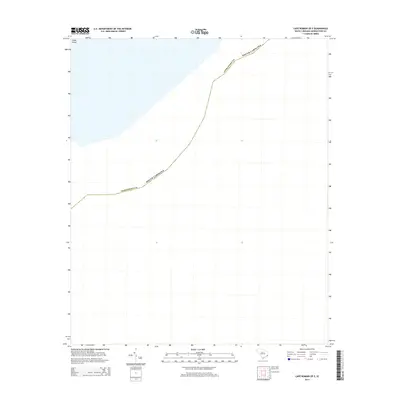
2014 Map of Cape Romain OE E
USGS Topo · Published 2014About this map
Georgetown County occupies the majority of this coastal survey, where the terrestrial landscape transitions into the open waters of the Atlantic. The northern edge of the sheet identifies a portion of Cedar Island, a landform that characterizes the delicate interface between the mainland and the sea in this part of South Carolina. This specific quadrangle captures a largely aquatic expanse, emphasizing the significance of the maritime boundary and the low-lying island topography that defines the coastal geography of the region. The map focuses on the precise demarcation of the county and state lines as they extend into the coastal waters.
Find a feature on this map
2 named features on this map. Tap any name to fly to it.
Don’t see what you’re looking for? This feature index may not catch every label — zoom into the map to look around manually.
Map Details
Editions of this 2014 Cape Romain OE E Map
This is the sole edition of this map. No revisions or reprints were ever made.
Other maps of this area

1942 · Cape Romain
USGS Topo · 1:24,000

1942 · Santee Point
USGS Topo · 1:24,000

1943 · Minim Island
USGS Topo · 1:24,000

1948 · James Island
USGS Topo · 1:250,000

1949 · Georgetown
USGS Topo · 1:250,000

1967 · Georgetown
USGS Topo · 1:250,000
1968 · James Island
USGS Topo · 1:250,000
1969 · James Island
USGS Topo · 1:250,000

1974 · Georgetown
USGS Topo · 1:250,000

1986 · Georgetown
USGS Topo · 1:100,000