
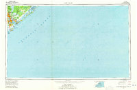
1942 Map of Cape Romain
USGS Topo · Published 1962About this map
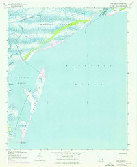
Cape Romain National Wildlife Refuge dominates this coastal survey, preserving a complex of barrier islands and salt marshes along the South Carolina coast during the early 1940s. The landscape is defined by the shifting sands of Cape Island and Lighthouse Island, which protect the inner waters of Cape Romain Harbor. The northern portion of the sheet shows the transition from the Atlantic Ocean to the mainland through a network of tidal passages including Alligator Creek and Ramhorn Creek. The map documents the vital maritime artery of the Intracoastal Waterway as it cuts behind Murphy Island. This area marks the political boundary between two counties, defined by the South Santee River, showing the natural geography that shaped local navigation and land use before mid-century development altered the regional coastline.
Find a feature on this map
18 named features on this map. Tap any name to fly to it.
Don’t see what you’re looking for? This feature index may not catch every label — zoom into the map to look around manually.
Map Details
Editions of this 1942 Cape Romain Map
4 editions found
Other maps of this area

1942 · Mc Clellanville
USGS Topo · 1:24,000

1942 · Santee Point
USGS Topo · 1:24,000

1943 · Santee
USGS Topo · 1:24,000

1943 · Minim Island
USGS Topo · 1:24,000

1948 · James Island
USGS Topo · 1:250,000

1949 · Georgetown
USGS Topo · 1:250,000

1967 · Georgetown
USGS Topo · 1:250,000
1968 · James Island
USGS Topo · 1:250,000
1969 · James Island
USGS Topo · 1:250,000

1974 · Georgetown
USGS Topo · 1:250,000