1942 Map of Cape Romain
USGS Topo · Published 1989About this map
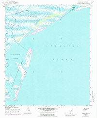
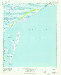
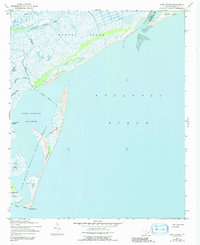
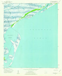
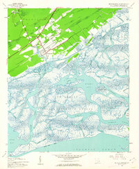
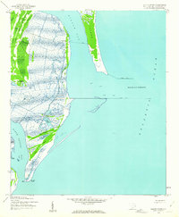
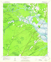
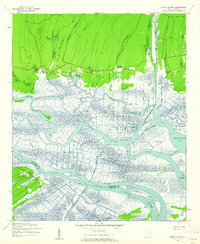
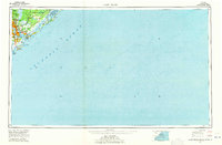
Cape Romain National Wildlife Refuge dominates this coastal survey, preserving a complex system of barrier islands and salt marshes along the South Carolina coast. The map illustrates the dynamic interface between the Atlantic Ocean and the sheltered waters of Cape Romain Harbor. Significant landforms including Murphy Island and Cape Island show the intricate network of tidal guts such as Alligator Creek and Needles Eye Creek. The path of the Intracoastal Waterway cuts through the northern marshlands, signifying the region's importance for maritime transit. Notable landmarks like Lighthouse Island and Deepwater Point mark the transition from the protected sounds to the open sea. This edition, based on 1942 data with 1973 photorevisions, captures the shoreline at a time when the boundary between Charleston and Georgetown counties was defined by the winding course of the South Santee River.
Find a feature on this map
18 named features on this map. Tap any name to fly to it.
Don’t see what you’re looking for? This feature index may not catch every label — zoom into the map to look around manually.
Map Details
Editions of this 1942 Cape Romain Map
4 editions found
Other maps of this area
1942 · Cape Romain
USGS Topo · 1:24,000
1942 · Mc Clellanville
USGS Topo · 1:24,000
1942 · Santee Point
USGS Topo · 1:24,000
1943 · Santee
USGS Topo · 1:24,000
1943 · Minim Island
USGS Topo · 1:24,000

1948 · James Island
USGS Topo · 1:250,000

1949 · Georgetown
USGS Topo · 1:250,000

1967 · Georgetown
USGS Topo · 1:250,000

1968 · James Island
USGS Topo · 1:250,000
1969 · James Island
USGS Topo · 1:250,000