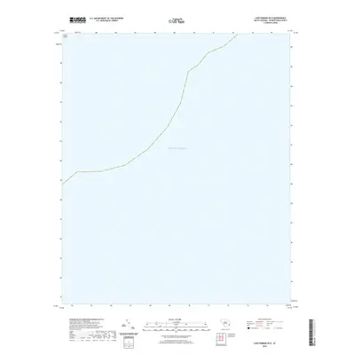
2020 Map of Cape Romain OE E
USGS Topo · Published 2020About this map
The Atlantic Ocean dominates this maritime survey off the South Carolina coast, showing the interface between the open sea and the marshy edges of Georgetown County. The northernmost portion of the map captures the southern tip of Cedar Island, a barrier feature that forms part of the region's complex coastal island chain. This 2020 edition provides a precise view of the shoreline as it existed before the most recent decade of coastal changes, serving as a primary reference for tracking the shifting sands and tidal boundaries that define this section of the Lowcountry coastline.
Find a feature on this map
2 named features on this map. Tap any name to fly to it.
Don’t see what you’re looking for? This feature index may not catch every label — zoom into the map to look around manually.
Map Details
Editions of this 2020 Cape Romain OE E Map
This is the sole edition of this map. No revisions or reprints were ever made.
Other maps of this area

1942 · Cape Romain
USGS Topo · 1:24,000

1942 · Santee Point
USGS Topo · 1:24,000

1943 · Minim Island
USGS Topo · 1:24,000

1948 · James Island
USGS Topo · 1:250,000

1949 · Georgetown
USGS Topo · 1:250,000

1967 · Georgetown
USGS Topo · 1:250,000
1968 · James Island
USGS Topo · 1:250,000
1969 · James Island
USGS Topo · 1:250,000

1974 · Georgetown
USGS Topo · 1:250,000

1986 · Georgetown
USGS Topo · 1:100,000