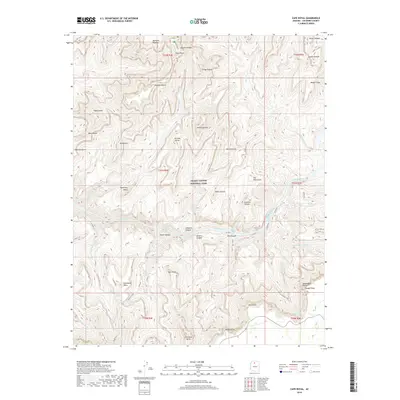
2018 Map of Cape Royal
USGS Topo · Published 2018About this map
Cape Royal and the Walhalla Plateau define the high northern rim of this section of Grand Canyon National Park, looking down into a landscape defined by massive geological monuments and the powerful flow of the Colorado River. The river's descent is marked by formidable obstacles including Sockdolager Rapids, Nevills Rapids, and Hance Rapids, which have challenged river travelers for generations. Surrounding these waters are named formations with mythological and architectural motifs, such as the Vishnu Temple, Krishna Shrine, and The Tabernacle. Evidence of early resource exploration is visible in the naming of Asbestos Canyon and Mineral Canyon near the riverbanks. To the south, the terrain rises toward Zuni Point and Moran Point, while trails like E Tonto and Grandview traverse the side canyons and plateaus, providing a network for traversing this complex vertical environment.
Find a feature on this map
54 named features on this map. Tap any name to fly to it.
Don’t see what you’re looking for? This feature index may not catch every label — zoom into the map to look around manually.
Map Details
Editions of this 2018 Cape Royal Map
This is the sole edition of this map. No revisions or reprints were ever made.
Other maps of this area

1886 · San Francisco Mtns
USGS Topo · 1:250,000

1886 · Chino
USGS Topo · 1:250,000

1886 · Echo Cliffs
USGS Topo · 1:250,000

1886 · Kaibab
USGS Topo · 1:250,000

1891 · San Francisco Mtns
USGS Topo · 1:250,000

1891 · Chino
USGS Topo · 1:250,000

1891 · Echo Cliffs
USGS Topo · 1:250,000

1894 · San Francisco Mtns
USGS Topo · 1:250,000

1899 · San Francisco Mtns
USGS Topo · 1:250,000

1903 · Bright Angel
USGS Topo · 1:48,000