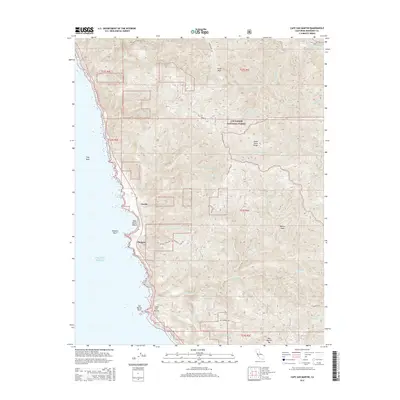
2015 Map of Cape San Martin
USGS Topo · Published 2015About this map
Gorda and the small settlement at Plaskett occupy the narrow coastal terrace of Monterey County, where the Santa Lucia Range meets the Pacific Ocean. This 2015 topography shows a landscape defined by steep drainages and high coastal peaks, including Chalk Peak and Willow Peak, which rise sharply from the shoreline. The map documents the complex network of mountain roads and trails such as Coast Ridge Trl and Los Burros Rd that navigate the ridges of the Los Padres National Forest. Along the water, distinct landmarks like Plaskett Rock, San Martin Rock, and Sand Dollar Beach provide specific points of reference for this coastal stretch. Inland, the headwaters of the Nacimiento River and its various forks, including the Negro Fork Nacimiento River, illustrate the drainage patterns moving away from the coastal divide.
Find a feature on this map
37 named features on this map. Tap any name to fly to it.
Don’t see what you’re looking for? This feature index may not catch every label — zoom into the map to look around manually.
Map Details
Editions of this 2015 Cape San Martin Map
This is the sole edition of this map. No revisions or reprints were ever made.
Other maps of this area

1919 · Junipero Serra
USGS Topo · 1:62,500

1921 · Cape San Martin
USGS Topo · 1:62,500

1921 · Lucia
USGS Topo · 1:62,500

1941 · Cape San Martin
USGS Topo · 1:62,500

1941 · Lucia
USGS Topo · 1:62,500

1941 · Junipero Serra
USGS Topo · 1:62,500

1942 · Cape San Martin
USGS Topo · 1:62,500

1947 · Lucia
USGS Topo · 1:62,500

1947 · San Luis Obispo
USGS Topo · 1:250,000

1948 · Santa Cruz
USGS Topo · 1:250,000