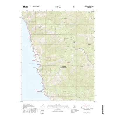
2018 Map of Cape San Martin
USGS Topo · Published 2018About this map
Gorda and Plaskett occupy the narrow coastal terrace along the central California coast, where steep mountains meet the Pacific Ocean. This 2018 survey detail provides a contemporary look at these small settlements and the land use patterns along this dramatic shoreline. The map delineates the boundary of FHL, indicating the military presence of Fort Hunter Liggett in the higher elevations. These labels trace the primary points of activity along the coast, offering insight into the sparse habitation of this remote section of Monterey County. The topographical data clarifies how geography dictates the placement of buildings and infrastructure between the mountain ridges and the sea.
Find a feature on this map
4 named features on this map. Tap any name to fly to it.
Don’t see what you’re looking for? This feature index may not catch every label — zoom into the map to look around manually.
Map Details
Editions of this 2018 Cape San Martin Map
This is the sole edition of this map. No revisions or reprints were ever made.
Other maps of this area

1919 · Junipero Serra
USGS Topo · 1:62,500

1921 · Cape San Martin
USGS Topo · 1:62,500

1921 · Lucia
USGS Topo · 1:62,500

1941 · Cape San Martin
USGS Topo · 1:62,500

1941 · Lucia
USGS Topo · 1:62,500

1941 · Junipero Serra
USGS Topo · 1:62,500

1942 · Cape San Martin
USGS Topo · 1:62,500

1947 · Lucia
USGS Topo · 1:62,500

1947 · San Luis Obispo
USGS Topo · 1:250,000

1948 · Santa Cruz
USGS Topo · 1:250,000