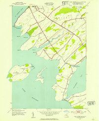
1942 Map of Cape Vincent South
USGS Topo · Published 1954About this map
The Tibbets Point Lighthouse stands at the strategic meeting point of the St Lawrence River and Lake Ontario, marking the entrance to the Great Lakes shipping channels. This 1942 survey captures a landscape defined by its maritime geography and rural educational structure, featuring numerous district schools such as School No 12 and School No 16 scattered across the mainland and offshore on Grenadier Island. The transport network of the era is anchored by the New York Central railroad terminus at Cape Vincent and the coastal Pleasant Valley Road. Notable for genealogists and local historians are the specific landforms like Long Carrying Place, which suggests historical portage routes between the river and the expansive Chaumont Bay to the south.
Find a feature on this map
33 named features on this map. Tap any name to fly to it.
Don’t see what you’re looking for? This feature index may not catch every label — zoom into the map to look around manually.
Map Details
Editions of this 1942 Cape Vincent South Map
2 editions found

Other maps of this area

1893 · Sackets Harbor
USGS Topo · 1:62,500

1895 · Sacketts Harbor
USGS Topo · 1:62,500

1895 · Stony Island
USGS Topo · 1:62,500

1895 · Cape Vincent
USGS Topo · 1:62,500

1900 · Clayton
USGS Topo · 1:62,500

1903 · Clayton
USGS Topo · 1:62,500

1942 · Cape Vincent North
USGS Topo · 1:31,680

1942 · Henderson Bay
USGS Topo · 1:31,680

1942 · Chaumont
USGS Topo · 1:31,680

1942 · Galloo Island
USGS Topo · 1:31,680