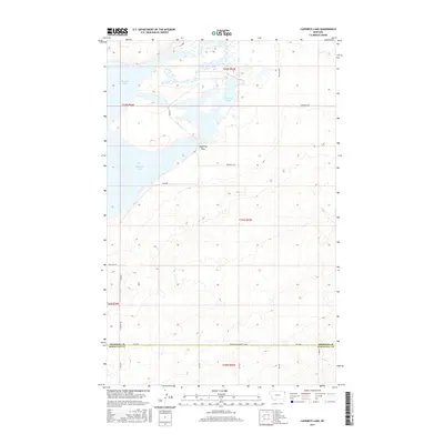
2017 Map of Capeneys Lake
USGS Topo · Published 2017About this map
Medicine Lake dominates the northwestern corner of this landscape along the border of Roosevelt and Sheridan counties. The area is defined by its water systems and the depressions that collect them, including the central Capeneys Lake and the drainage of Sand Cr to the northeast. A network of rural section-line roads, such as Ten Mile Rd and Sandhills Rd, provides access across the glaciated terrain. The topography is further punctuated by Gaffney Pass, a geographic transition point between the larger lake basin and the surrounding prairie. This 2017 survey details the contemporary road network, from local routes like Deubner Rd to the southern Sheridan-Roosevelt Co Rd, reflecting the sparse but organized settlement pattern of the northeastern Montana plains.
Find a feature on this map
24 named features on this map. Tap any name to fly to it.
Don’t see what you’re looking for? This feature index may not catch every label — zoom into the map to look around manually.
Map Details
Editions of this 2017 Capeneys Lake Map
This is the sole edition of this map. No revisions or reprints were ever made.
Other maps of this area

1946 · Dagmar
USGS Topo · 1:24,000

1947 · Capeneys Lake
USGS Topo · 1:24,000

1948 · Capeneys Lake
USGS Topo · 1:24,000

1948 · Dagmar
USGS Topo · 1:24,000

1948 · Reserve SE
USGS Topo · 1:24,000

1948 · Sunnyhill School
USGS Topo · 1:24,000

1948 · Medicine Lake
USGS Topo · 1:24,000

1948 · Reserve
USGS Topo · 1:24,000

1949 · Reserve SE
USGS Topo · 1:24,000

1949 · Sunnyhill School
USGS Topo · 1:24,000