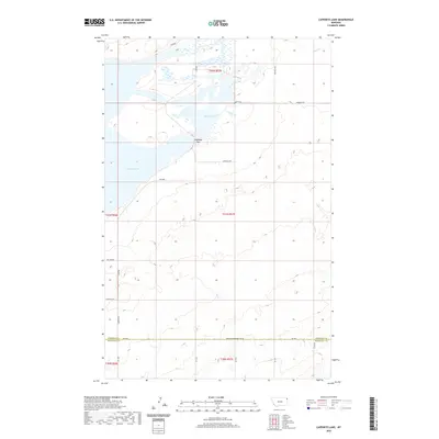
2020 Map of Capeneys Lake
USGS Topo · Published 2020About this map
Capeneys Lake and the northern portion of Medicine Lake anchor this landscape along the border of Roosevelt and Sheridan Counties. The map reveals a remote prairie environment defined by seasonal hydrology and subtle elevation changes, notably at Gaffney Pass. Settlement patterns are sparse, with the community of Lakeside situated along the western shore. The transportation network consists primarily of section-line roads and specialized routes like Sharptail Rd and Big Lake Rd, reflecting a land use tied to the open range and local water access. In the northeast, Sand Cr meanders toward the larger lake basins, while the Sheridan-Roosevelt Co Rd serves as a primary east-west corridor for the region.
Find a feature on this map
24 named features on this map. Tap any name to fly to it.
Don’t see what you’re looking for? This feature index may not catch every label — zoom into the map to look around manually.
Map Details
Editions of this 2020 Capeneys Lake Map
This is the sole edition of this map. No revisions or reprints were ever made.
Other maps of this area

1946 · Dagmar
USGS Topo · 1:24,000

1947 · Capeneys Lake
USGS Topo · 1:24,000

1948 · Capeneys Lake
USGS Topo · 1:24,000

1948 · Dagmar
USGS Topo · 1:24,000

1948 · Reserve SE
USGS Topo · 1:24,000

1948 · Sunnyhill School
USGS Topo · 1:24,000

1948 · Medicine Lake
USGS Topo · 1:24,000

1948 · Reserve
USGS Topo · 1:24,000

1949 · Reserve SE
USGS Topo · 1:24,000

1949 · Sunnyhill School
USGS Topo · 1:24,000