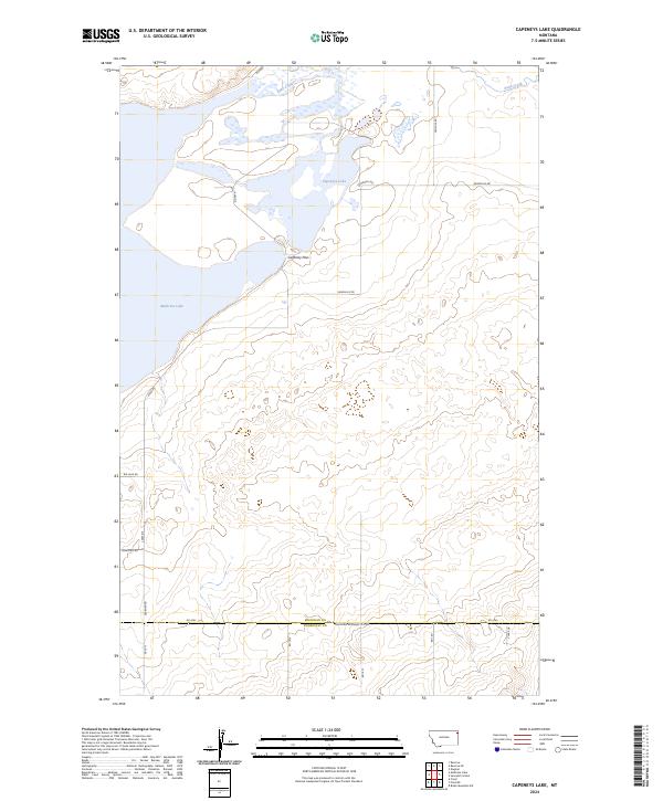
2024 Map of Capeneys Lake
USGS Topo · Published 2024About this map
Medicine Lake National Wildlife Refuge and the surrounding wilderness dominate this portion of the Montana prairie, where the landscape transitions from glacial wetlands to the arid stretches of the Missouri Coteau. The map details a complex hydrologic network centered on Medicine Lake and the smaller Capeneys Lake, connected by Lake Creek. These water bodies are critical landmarks in a region defined by its wide horizons and the historical border between the Sheridan and Roosevelt jurisdictions, marked here by the Sheridan-Roosevelt Co Rd.
Find a feature on this map
27 named features on this map. Tap any name to fly to it.
Don’t see what you’re looking for? This feature index may not catch every label — zoom into the map to look around manually.
Map Details
Editions of this 2024 Capeneys Lake Map
This is the sole edition of this map. No revisions or reprints were ever made.
Other maps of this area

1946 · Dagmar
USGS Topo · 1:24,000

1947 · Capeneys Lake
USGS Topo · 1:24,000

1948 · Capeneys Lake
USGS Topo · 1:24,000

1948 · Dagmar
USGS Topo · 1:24,000

1948 · Reserve SE
USGS Topo · 1:24,000

1948 · Sunnyhill School
USGS Topo · 1:24,000

1948 · Medicine Lake
USGS Topo · 1:24,000

1948 · Reserve
USGS Topo · 1:24,000

1949 · Reserve SE
USGS Topo · 1:24,000

1949 · Sunnyhill School
USGS Topo · 1:24,000