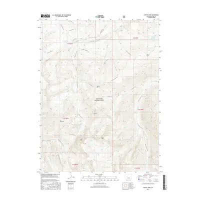
2016 Map of Capitol Peak
USGS Topo · Published 2016About this map
White River National Forest defines the character of this high-elevation terrain in the Elk Mountains, dominated by the towering spire of Capitol Peak. The landscape is a network of alpine drainage basins and steep ridges, where water from the Pierre Lakes and Capitol Lake feeds into the winding Capitol Cr. This 2016 survey illustrates the intricate trail systems used to navigate the wilderness, including the Capitol Creek Trail and the Maroon Snowmass Trail, which connect distant points like Avalanche Lake and the northern slopes near Mt Daly. The transition from the lower Little Elk Cr valley to the heights of Clark Peak reveals the logistical challenges of the area's high-country topography. Evidence of water management is visible at the edge of the forest boundary, where the Elk Cr Ditch and Elk Creek Reservoir Number 2 represent the intersection of mountain snowmelt and downstream utility.
Find a feature on this map
44 named features on this map. Tap any name to fly to it.
Don’t see what you’re looking for? This feature index may not catch every label — zoom into the map to look around manually.
Map Details
Editions of this 2016 Capitol Peak Map
This is the sole edition of this map. No revisions or reprints were ever made.
Other maps of this area

1893 · Aspen
USGS Topo · 1:62,500

1895 · Aspen
USGS Topo · 1:62,500

1909 · Mount Jackson
USGS Topo · 1:125,000

1911 · Mount Jackson
USGS Topo · 1:125,000

1957 · Leadville
USGS Topo · 1:250,000

1959 · Leadville
USGS Topo · 1:250,000

1960 · Leadville
USGS Topo · 1:250,000

1960 · Marble
USGS Topo · 1:24,000

1960 · Highland Peak
USGS Topo · 1:24,000

1960 · Maroon Bells
USGS Topo · 1:24,000