
1960 Map of Highland Peak
USGS Topo · Published 1964About this map
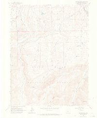
White River National Forest defines the topography of this Pitkin County landscape, characterized by the dramatic rise of the Elk Mountains in the early 1960s. The terrain is dominated by high summits including Highland Peak, Baldy Mountain, and Eagle Mtn, which overlook a complex network of glacial valleys and drainage systems. This 1960 field-checked survey reveals an early recreation and water-management landscape, featuring numerous campsites along Maroon Creek such as Maroon Creek Campground 1.
Find a feature on this map
34 named features on this map. Tap any name to fly to it.
Don’t see what you’re looking for? This feature index may not catch every label — zoom into the map to look around manually.
Map Details
Editions of this 1960 Highland Peak Map
4 editions found
Other maps of this area

1893 · Aspen
USGS Topo · 1:62,500

1895 · Aspen
USGS Topo · 1:62,500

1909 · Mount Jackson
USGS Topo · 1:125,000

1911 · Mount Jackson
USGS Topo · 1:125,000

1957 · Leadville
USGS Topo · 1:250,000

1959 · Leadville
USGS Topo · 1:250,000

1960 · Leadville
USGS Topo · 1:250,000

1960 · Maroon Bells
USGS Topo · 1:24,000
1960 · Hayden Peak
USGS Topo · 1:24,000

1960 · Capitol Peak
USGS Topo · 1:24,000