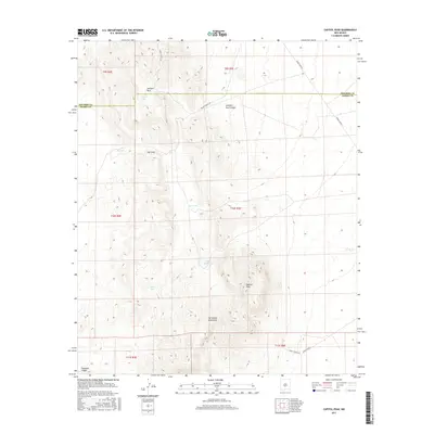
2017 Map of Capitol Peak
USGS Topo · Published 2017About this map
Capitol Peak rises as the dominant topographic landmark in this high-desert reach of the San Andres Mountains, situated along the boundary of Socorro and Sierra counties. The landscape is defined by its isolation and the distribution of artificial water catchments, including Line Tank, CCC Tank, and Mine Tank, which supported livestock and game in an arid environment. A network of restricted access roads, such as WSMR S Route 325 and WSMR P Route 7, suggests the modern character of this land as part of a military range. Historical features like Johnson Park and Hays Gap provide evidence of earlier land use patterns, while Thurgood Canyon and Johnson Park Canyon cut through the rugged slopes, illustrating the complex drainage systems that flow from the peaks toward the surrounding basins.
Find a feature on this map
21 named features on this map. Tap any name to fly to it.
Don’t see what you’re looking for? This feature index may not catch every label — zoom into the map to look around manually.
Map Details
Editions of this 2017 Capitol Peak Map
This is the sole edition of this map. No revisions or reprints were ever made.
Other maps of this area

1916 · Salinas Peak
USGS Topo · 1:125,000

1916 · Tularosa
USGS Topo · 1:125,000

1918 · Oscura Peak
USGS Topo · 1:125,000

1947 · Capitol Peak
USGS Topo · 1:62,500

1948 · Granjean Well
USGS Topo · 1:62,500

1948 · Mockingbird Gap
USGS Topo · 1:62,500

1948 · Salinas Peak
USGS Topo · 1:62,500

1954 · Tularosa
USGS Topo · 1:250,000

1958 · Tularosa
USGS Topo · 1:250,000

1981 · Fairview Mountain
USGS Topo · 1:24,000