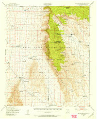
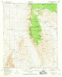
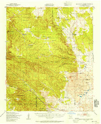
1948 Map of Mockingbird Gap
USGS Topo · Published 1955About this map
The Oscura Mountains bisect this high-desert landscape during the late 1940s, a period defined by the convergence of ranching heritage and Cold War military expansion. Large portions of the terrain are partitioned for the White Sands Proving Ground and the Alamogordo Bombing Range, reflecting the area's strategic importance for postwar weapons testing. Amidst this militarized zone, evidence of former habitation remains, such as the McDonald Ranch (Abandoned) and the Air Strip (Abandoned).
Find a feature on this map
50 named features on this map. Tap any name to fly to it.
Don’t see what you’re looking for? This feature index may not catch every label — zoom into the map to look around manually.
Map Details
Editions of this 1948 Mockingbird Gap Map
2 editions found
Other maps of this area

1916 · Salinas Peak
USGS Topo · 1:125,000

1916 · Tularosa
USGS Topo · 1:125,000

1918 · Oscura Peak
USGS Topo · 1:125,000
1947 · Three Rivers
USGS Topo · 1:62,500

1947 · Capitol Peak
USGS Topo · 1:62,500
1948 · Carthage
USGS Topo · 1:62,500
1948 · Broken Back Crater
USGS Topo · 1:62,500
1948 · Granjean Well
USGS Topo · 1:62,500
1948 · Bingham
USGS Topo · 1:62,500

1948 · Chihuahua Ranch
USGS Topo · 1:62,500