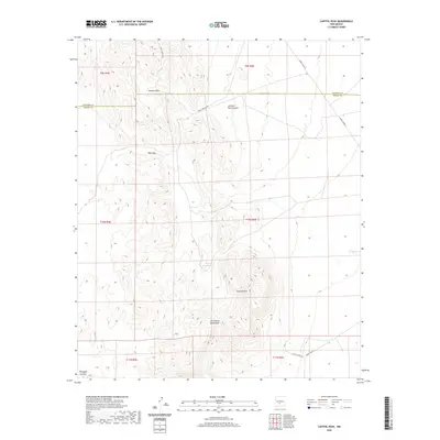
2020 Map of Capitol Peak
USGS Topo · Published 2020About this map
San Andres Mountains dominate the southern landscape of this 2020 survey, rising dramatically toward the summit of Capitol Peak. The terrain is defined by dry canyons and high basins, including Johnson Park and Johnson Park Canyon in the north, and Thurgood Canyon in the southwest. A notable artifact of mid-century infrastructure appears as CCC Tank, likely dating to Civilian Conservation Corps projects in the region. The map reflects the modern military management of the area, as the road network consists almost entirely of White Sands Missile Range access routes such as WSMR S Route 325, WSMR P Route 7, and WSMR S Route 319. This high-desert environment shows very little human settlement, focused instead on water management features like Capitol Peak Tank and the topographical challenges of Hays Gap.
Find a feature on this map
18 named features on this map. Tap any name to fly to it.
Don’t see what you’re looking for? This feature index may not catch every label — zoom into the map to look around manually.
Map Details
Editions of this 2020 Capitol Peak Map
This is the sole edition of this map. No revisions or reprints were ever made.
Other maps of this area

1916 · Salinas Peak
USGS Topo · 1:125,000

1916 · Tularosa
USGS Topo · 1:125,000

1918 · Oscura Peak
USGS Topo · 1:125,000

1947 · Capitol Peak
USGS Topo · 1:62,500

1948 · Granjean Well
USGS Topo · 1:62,500

1948 · Mockingbird Gap
USGS Topo · 1:62,500

1948 · Salinas Peak
USGS Topo · 1:62,500

1954 · Tularosa
USGS Topo · 1:250,000

1958 · Tularosa
USGS Topo · 1:250,000

1981 · Fairview Mountain
USGS Topo · 1:24,000