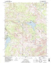
1992 Map of Caples Lake
USGS Topo · Published 1994About this map
Kirkwood Ski Resort and the surrounding high-altitude terrain of the Eldorado National Forest define this landscape during the early 1990s. This survey records a transition between recreation and historical transit, showing the expansion of Kirkwood alongside older landmarks like the Old Emigrant Trail Historical Marker. The map details a cluster of seasonal camps and resorts, including Kit Carson Resort and Caples Lake Resort, nestled near significant water bodies like Silver Lake and Caples Lake.
Find a feature on this map
64 named features on this map. Tap any name to fly to it.
Don’t see what you’re looking for? This feature index may not catch every label — zoom into the map to look around manually.
Map Details
Editions of this 1992 Caples Lake Map
3 editions found
Other maps of this area

1889 · Pyramid Peak
USGS Topo · 1:125,000

1889 · Markleeville
USGS Topo · 1:125,000

1891 · Markleeville
USGS Topo · 1:125,000

1891 · Pyramid Peak
USGS Topo · 1:125,000

1893 · Markleeville
USGS Topo · 1:125,000

1895 · Pyramid Peak
USGS Topo · 1:125,000

1896 · Pyramid Peak
USGS Topo · 1:125,000

1947 · Sacramento
USGS Topo · 1:250,000

1948 · Walker Lake
USGS Topo · 1:250,000

1948 · Sacramento
USGS Topo · 1:250,000