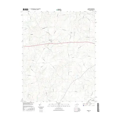
2016 Map of Capron
USGS Topo · Published 2016About this map
Capron and Newsoms anchor this survey of southern Southampton County, where the landscape is defined by the dense, branching wetlands of the coastal plain. Large drainage systems like Sweat Swamp, Buckhorn Swamp, and Rosa Swamp weave through the region, dictating the placement of early settlements and road networks. Smaller rural communities like Angelico, Worrell, and Pope are connected by a web of historically significant routes, including Old Belfield Rd and Indian Woods Trl. The presence of the Capron Cem and several ponds, such as McGraphs Pond and Princes Pond, provides specific points of interest for genealogists tracing family landholdings. This map illustrates the enduring relationship between Virginia's swampy hydrology and its agricultural settlement patterns, where dry ridges between the "swamps" have historically supported the area's development.
Find a feature on this map
59 named features on this map. Tap any name to fly to it.
Don’t see what you’re looking for? This feature index may not catch every label — zoom into the map to look around manually.
Map Details
Editions of this 2016 Capron Map
This is the sole edition of this map. No revisions or reprints were ever made.
Other maps of this area

1919 · Jarratt
USGS Topo · 1:62,500

1919 · Homeville
USGS Topo · 1:48,000

1919 · Boykins
USGS Topo · 1:48,000

1919 · Arringdale
USGS Topo · 1:48,000

1920 · Homeville
USGS Topo · 1:62,500

1920 · Boykins
USGS Topo · 1:62,500

1920 · Arringdale
USGS Topo · 1:62,500

1942 · Arringdale
USGS Topo · 1:62,500

1943 · Sebrell
USGS Topo · 1:31,680

1943 · Vicksville
USGS Topo · 1:31,680