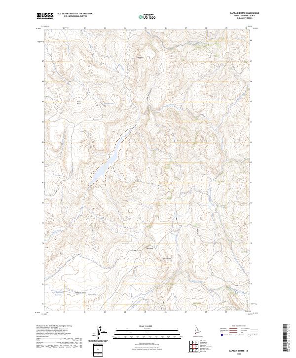
2023 Map of Captain Butte
USGS Topo · Published 2023About this map
Captain Butte and the surrounding high desert of Owyhee County are meticulously documented in this contemporary survey, illustrating a landscape where water is the primary architect of both the terrain and its history. The drainage networks of Succor Creek and Jackson Creek define the movements across this arid region, linking several vital water sources such as Texas Basin Spring, Rim Spring, and Arrow Spring. The topographic prominence of Table Rock and Flattop Butte serves as a reminder of the geologic forces that shaped the Coal Mine Basin. While largely open range, the presence of the SW Gate Gulch Reservoir and named routes like Westgate Gulch suggest a history of livestock management and resource utilization in a demanding environment. This map provides a precise account of a landscape where every named spring and drainage represents a crucial survival point for those who have traversed these Owyhee highlands.
Find a feature on this map
25 named features on this map. Tap any name to fly to it.
Don’t see what you’re looking for? This feature index may not catch every label — zoom into the map to look around manually.
Map Details
Editions of this 2023 Captain Butte Map
This is the sole edition of this map. No revisions or reprints were ever made.
Other maps of this area

1892 · Silver City
USGS Topo · 1:125,000

1894 · Silver City
USGS Topo · 1:125,000

1898 · Silver City
USGS Topo · 1:125,000

1955 · Boise
USGS Topo · 1:250,000

1957 · Sands Basin
USGS Topo · 1:62,500

1958 · Boise
USGS Topo · 1:250,000

1962 · Boise
USGS Topo · 1:250,000

1965 · Rooster Comb Peak
USGS Topo · 1:62,500

1967 · Rockville
USGS Topo · 1:24,000
1969 · Hooker Creek
USGS Topo · 1:24,000