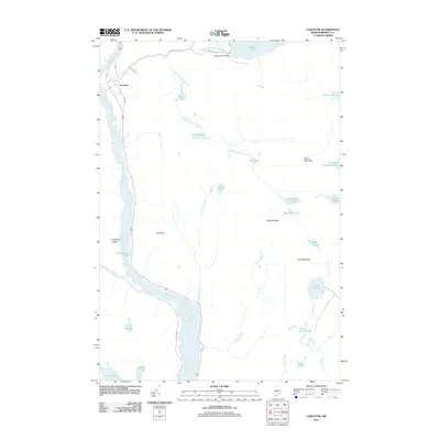
2011 Map of Caratunk
USGS Topo · Published 2011About this map
Caratunk serves as the primary settlement hub in this part of Somerset County, situated along the eastern bank of the Kennebec River. The landscape is defined by its complex network of waterways and drainage, including Pleasant Pond Stream which flows from the large Pleasant Pond in the northeast corner of the sheet. At the pond's outlet, the Pleasant Pond Dam marks a point of historical water management, while the presence of Log Landing Pond suggests the region's enduring connection to the timber industry. To the south and east, the terrain rises toward significant heights like Moxie Mountain and Cow Mountain, interspersed with numerous smaller basins such as Doughnut Pond, Chase Bog, and Decker Ponds. This map documents a sparsely populated but ecologically rich area where small roads like Carry Pond Rd and Fish Hatchery Rd wind through the hills and wetlands of the Maine woods.
Find a feature on this map
38 named features on this map. Tap any name to fly to it.
Don’t see what you’re looking for? This feature index may not catch every label — zoom into the map to look around manually.
Map Details
Editions of this 2011 Caratunk Map
This is the sole edition of this map. No revisions or reprints were ever made.
Other maps of this area

1903 · Bingham
USGS Topo · 1:62,500

1905 · Bingham
USGS Topo · 1:62,500

1905 · The Forks
USGS Topo · 1:62,500

1907 · The Forks
USGS Topo · 1:62,500

1925 · Pierce Pond
USGS Topo · 1:48,000

1927 · Pierce Pond
USGS Topo · 1:62,500

1928 · Dead River
USGS Topo · 1:62,500

1931 · Dead River
USGS Topo · 1:48,000

1944 · Dead River
USGS Topo · 1:62,500

1944 · Pierce Pond
USGS Topo · 1:62,500