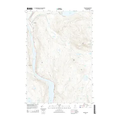
2014 Map of Caratunk
USGS Topo · Published 2014About this map
The Kennebec River flows southward through this Somerset County landscape, defining the western corridor where the settlement of Caratunk and Us-201 are established. This 2014 survey captures the area’s reliance on the river and its tributaries, including Pleasant Pond Stream and Robinson Pond Outlet. To the east, the terrain rises sharply toward Moxie Mtn and Cow Mtn, revealing a wilderness dotted with numerous isolated water bodies such as Decker Ponds, Doughnut Pond, and Chase Pond. The Appalachian National Scenic Trail winds through the northern reaches, crossing the river near the village center. Local heritage is marked by the Caratunk Cem and Stevens Cem, providing anchor points for genealogical research near the shores of Wyman Lake. The map details a network of backcountry routes like Canada Rd and Carry Pond Rd that serve the timberlands and remote ponds between the peaks of Black Nubble and Henhawk Ledge.
Find a feature on this map
44 named features on this map. Tap any name to fly to it.
Don’t see what you’re looking for? This feature index may not catch every label — zoom into the map to look around manually.
Map Details
Editions of this 2014 Caratunk Map
This is the sole edition of this map. No revisions or reprints were ever made.
Other maps of this area

1903 · Bingham
USGS Topo · 1:62,500

1905 · Bingham
USGS Topo · 1:62,500

1905 · The Forks
USGS Topo · 1:62,500

1907 · The Forks
USGS Topo · 1:62,500

1925 · Pierce Pond
USGS Topo · 1:48,000

1927 · Pierce Pond
USGS Topo · 1:62,500

1928 · Dead River
USGS Topo · 1:62,500

1931 · Dead River
USGS Topo · 1:48,000

1944 · Dead River
USGS Topo · 1:62,500

1944 · Pierce Pond
USGS Topo · 1:62,500