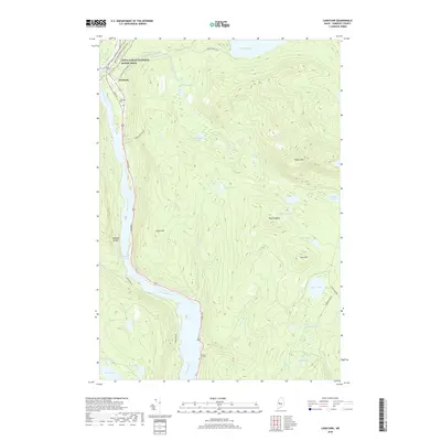
2018 Map of Caratunk
USGS Topo · Published 2018About this map
Caratunk serves as a small waypoint on the Kennebec River in Somerset County, where the historic Appalachian National Scenic Trail crosses through the northern woods. This 2018 survey reveals a landscape where the river and high ridges like Moxie Mtn and Black Nubble dictate the layout of roads and small settlements. Along the western edge, Main St and Canada Rd parallel the river, connecting the local population at Caratunk Cem and Stevens Cem to the surrounding wilderness.
Find a feature on this map
41 named features on this map. Tap any name to fly to it.
Don’t see what you’re looking for? This feature index may not catch every label — zoom into the map to look around manually.
Map Details
Editions of this 2018 Caratunk Map
This is the sole edition of this map. No revisions or reprints were ever made.
Other maps of this area

1903 · Bingham
USGS Topo · 1:62,500

1905 · Bingham
USGS Topo · 1:62,500

1905 · The Forks
USGS Topo · 1:62,500

1907 · The Forks
USGS Topo · 1:62,500

1925 · Pierce Pond
USGS Topo · 1:48,000

1927 · Pierce Pond
USGS Topo · 1:62,500

1928 · Dead River
USGS Topo · 1:62,500

1931 · Dead River
USGS Topo · 1:48,000

1944 · Dead River
USGS Topo · 1:62,500

1944 · Pierce Pond
USGS Topo · 1:62,500