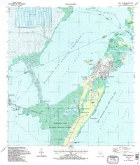
1988 Map of Card Sound
USGS Topo · Published 1988About this map
Crocodile Lake National Wildlife Refuge dominates the southern landscape of this 1980s coastal study, preserving the delicate mangrove ecosystems where Card Sound meets the Atlantic. This era captures the significant development of the northern tip of Key Largo, centered around the Ocean Reef Club with its private Ocean Reef Club Landing Strip and structured residential canals. To the north, the map details the intricate network of the upper keys, including Old Rhodes Key and Angelfish Key, separated by tidal channels like Angelfish Creek.
Find a feature on this map
56 named features on this map. Tap any name to fly to it.
Don’t see what you’re looking for? This feature index may not catch every label — zoom into the map to look around manually.
Map Details
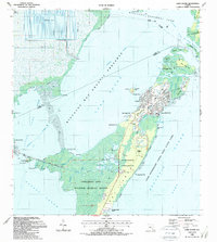
Editions of this 1988 Card Sound Map
2 editions found
Other maps of this area

1947 · Garden Cove
USGS Topo · 1:24,000

1947 · Blackwater Sound
USGS Topo · 1:24,000

1949 · Blackwater Sound
USGS Topo · 1:24,000

1949 · Garden Cove
USGS Topo · 1:24,000

1949 · Elliott Key
USGS Topo · 1:24,000

1949 · Card Sound
USGS Topo · 1:24,000

1949 · Pacific Reef
USGS Topo · 1:24,000

1949 · Arsenicker Keys
USGS Topo · 1:24,000

1950 · Homestead
USGS Topo · 1:24,000

1950 · Glades
USGS Topo · 1:24,000