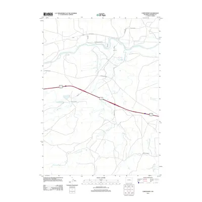
2012 Map of Careyhurst
USGS Topo · Published 2012About this map
Careyhurst and the neighboring Careyhurst Ranch anchor this 2012 survey of the North Platte river valley in Converse County. The landscape is defined by the winding course of the North Platte River and its numerous tributaries, including Box Elder Creek and Little Box Elder Creek, which drain the southern highlands. Small track-side locations like Welch, Fletcher, and Carey mark the historical transit corridor through this portion of Wyoming. The map reveals a transition from these riparian ranch lands to the industrial and agricultural infrastructure accessed via routes such as Tank Farm Rd and Old Douglas Hwy. This modern topographical study captures the intersection of established cattle-ranching heritage and the evolving road network that serves the region's energy and transport needs.
Find a feature on this map
20 named features on this map. Tap any name to fly to it.
Don’t see what you’re looking for? This feature index may not catch every label — zoom into the map to look around manually.
Map Details
Editions of this 2012 Careyhurst Map
This is the sole edition of this map. No revisions or reprints were ever made.
Other maps of this area

1949 · Orpha
USGS Topo · 1:24,000

1949 · Careyhurst
USGS Topo · 1:24,000

1949 · Gilbert Lake
USGS Topo · 1:24,000

1949 · Glenrock
USGS Topo · 1:24,000

1949 · Leuenberger Ranch
USGS Topo · 1:24,000

1949 · Hylton Ranch
USGS Topo · 1:24,000

1950 · Careyhurst
USGS Topo · 1:24,000

1950 · Gilbert Lake
USGS Topo · 1:24,000

1950 · Leuenberger Ranch
USGS Topo · 1:24,000

1950 · Orpha
USGS Topo · 1:24,000