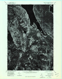
1978 Map of Caribou Lake South
USGS Topo · Published 1981About this map
Grant Farm sits at the heart of this North Woods landscape, serving as a primary point of human settlement amidst a dense network of Maine waterways. The 1978 aerial imagery reveals the sprawling reach of Caribou Lake and the southern tip of Chesuncook Lake, documenting the shoreline and timbered terrain before late-twentieth-century shifts in forest management. The winding path of Ragged Stream connects the larger basins with smaller, secluded water bodies like Bear Pond and Big Fisher Pond. This orthophotoquad captures the timberlands in a specific moment of transition, showing the clear contrast between the dark expanse of Ragged Lake and the varying textures of the surrounding vegetation and logging access points.
Find a feature on this map
8 named features on this map. Tap any name to fly to it.
Don’t see what you’re looking for? This feature index may not catch every label — zoom into the map to look around manually.
Map Details
Editions of this 1978 Caribou Lake South Map
This is the sole edition of this map. No revisions or reprints were ever made.
Other maps of this area

1952 · Jo-Mary Mountain
USGS Topo · 1:62,500

1952 · First Roach Pond
USGS Topo · 1:62,500

1954 · Grant Farm
USGS Topo · 1:62,500

1954 · Harrington Lake
USGS Topo · 1:62,500

1954 · Millinocket
USGS Topo · 1:250,000

1958 · Millinocket
USGS Topo · 1:250,000

1960 · Millinocket
USGS Topo · 1:250,000
1977 · Pine Stream Flowage
USGS Topo · 1:24,000
1977 · Big Spencer Mountain
USGS Topo · 1:24,000
1977 · Kokadjo
USGS Topo · 1:24,000