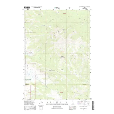
2017 Map of Caribou Mountain
USGS Topo · Published 2017About this map
Caribou Mountain dominates the central landscape of this Idaho interior, a high-relief terrain where the Caribou National Forest and the Grays Lake National Wildlife Refuge converge. The drainage patterns on this 2017 survey reveal a complex network of creeks including Tincup Cr, Eagle Cr, and Bridge Cr, which carve through the elevations near Morgan Meadow and Anderson Gulch. This modern survey details the primary access routes into the high country, such as Muir Rd, Grays Lake Rd, and several Forest Service development roads. The intersection of these routes near the Bonneville and Caribou County line highlights the area's importance for local management and ecological conservation, providing a clear view of the wilderness before it meets the marshlands to the west.
Find a feature on this map
30 named features on this map. Tap any name to fly to it.
Don’t see what you’re looking for? This feature index may not catch every label — zoom into the map to look around manually.
Map Details
Editions of this 2017 Caribou Mountain Map
This is the sole edition of this map. No revisions or reprints were ever made.
Other maps of this area

1915 · Freedom
USGS Topo · 1:62,500

1915 · Lanes Creek
USGS Topo · 1:62,500

1932 · Irwin
USGS Topo · 1:96,000

1935 · Irwin
USGS Topo · 1:125,000

1955 · Driggs
USGS Topo · 1:250,000

1955 · Preston
USGS Topo · 1:250,000

1958 · Driggs
USGS Topo · 1:250,000

1958 · Preston
USGS Topo · 1:250,000

1962 · Driggs
USGS Topo · 1:250,000

1962 · Preston
USGS Topo · 1:250,000