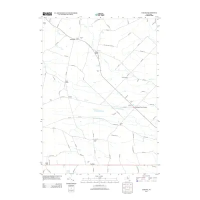
2013 Map of Carlisle
USGS Topo · Published 2013About this map
Currytown and its surrounding dairy farm country define the northern reaches of this Montgomery County landscape as it appeared in the early 21st century. The map reveals a deeply rooted rural settlement pattern where crossroads hamlets like Charleston Four Corners, Rural Grove, and Root Center remain connected by an intricate network of local roads such as Flat Creek Rd and Rural Grove Rd.
Find a feature on this map
87 named features on this map. Tap any name to fly to it.
Don’t see what you’re looking for? This feature index may not catch every label — zoom into the map to look around manually.
Map Details
Editions of this 2013 Carlisle Map
This is the sole edition of this map. No revisions or reprints were ever made.
Other maps of this area

1896 · Fonda
USGS Topo · 1:62,500

1898 · Fonda
USGS Topo · 1:62,500

1898 · Canajoharie
USGS Topo · 1:62,500

1898 · Schoharie
USGS Topo · 1:62,500

1900 · Canajoharie
USGS Topo · 1:62,500

1900 · Schoharie
USGS Topo · 1:62,500

1900 · Schoharie
USGS Topo · 1:31,680

1902 · Canajoharie
USGS Topo · 1:62,500

1902 · Fonda
USGS Topo · 1:62,500

1904 · Richmondville
USGS Topo · 1:62,500