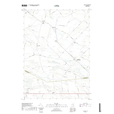
2019 Map of Carlisle
USGS Topo · Published 2019About this map
The agricultural landscape of the Montgomery and Schoharie county border is defined by upland ridges and small hamlets connected by an intricate network of county roads. Hamlets such as Currytown, Rural Grove, and Charleston Four Corners serve as historic nodes in a region characterized by small-scale aviation and deep-rooted community sites. Genealogists will find a wealth of burial records across this terrain, from the Haight Family Burial Ground and Friends Cem to the Currytown Reformed Church Cem. Waterways like Yatesville Cr and Flat Creek navigate the undulating topography, while larger natural features such as Bear Swamp and Little Bear Swamp mark the lowlands. The survey also notes Russell Airport and The Ranch Airport, reflecting the persistence of private aviation in rural New York. This area remains largely agrarian, with modern roads following established routes through Corbin Hill and Lykers, maintaining the spatial patterns of earlier centuries.
Find a feature on this map
89 named features on this map. Tap any name to fly to it.
Don’t see what you’re looking for? This feature index may not catch every label — zoom into the map to look around manually.
Map Details
Editions of this 2019 Carlisle Map
This is the sole edition of this map. No revisions or reprints were ever made.
Other maps of this area

1896 · Fonda
USGS Topo · 1:62,500

1898 · Fonda
USGS Topo · 1:62,500

1898 · Canajoharie
USGS Topo · 1:62,500

1898 · Schoharie
USGS Topo · 1:62,500

1900 · Canajoharie
USGS Topo · 1:62,500

1900 · Schoharie
USGS Topo · 1:62,500

1900 · Schoharie
USGS Topo · 1:31,680

1902 · Canajoharie
USGS Topo · 1:62,500

1902 · Fonda
USGS Topo · 1:62,500

1904 · Richmondville
USGS Topo · 1:62,500